Mumbai Metro Map
Interactive Mumbai Metro route map - all operational lines, upcoming phases and suburban connections in one view.
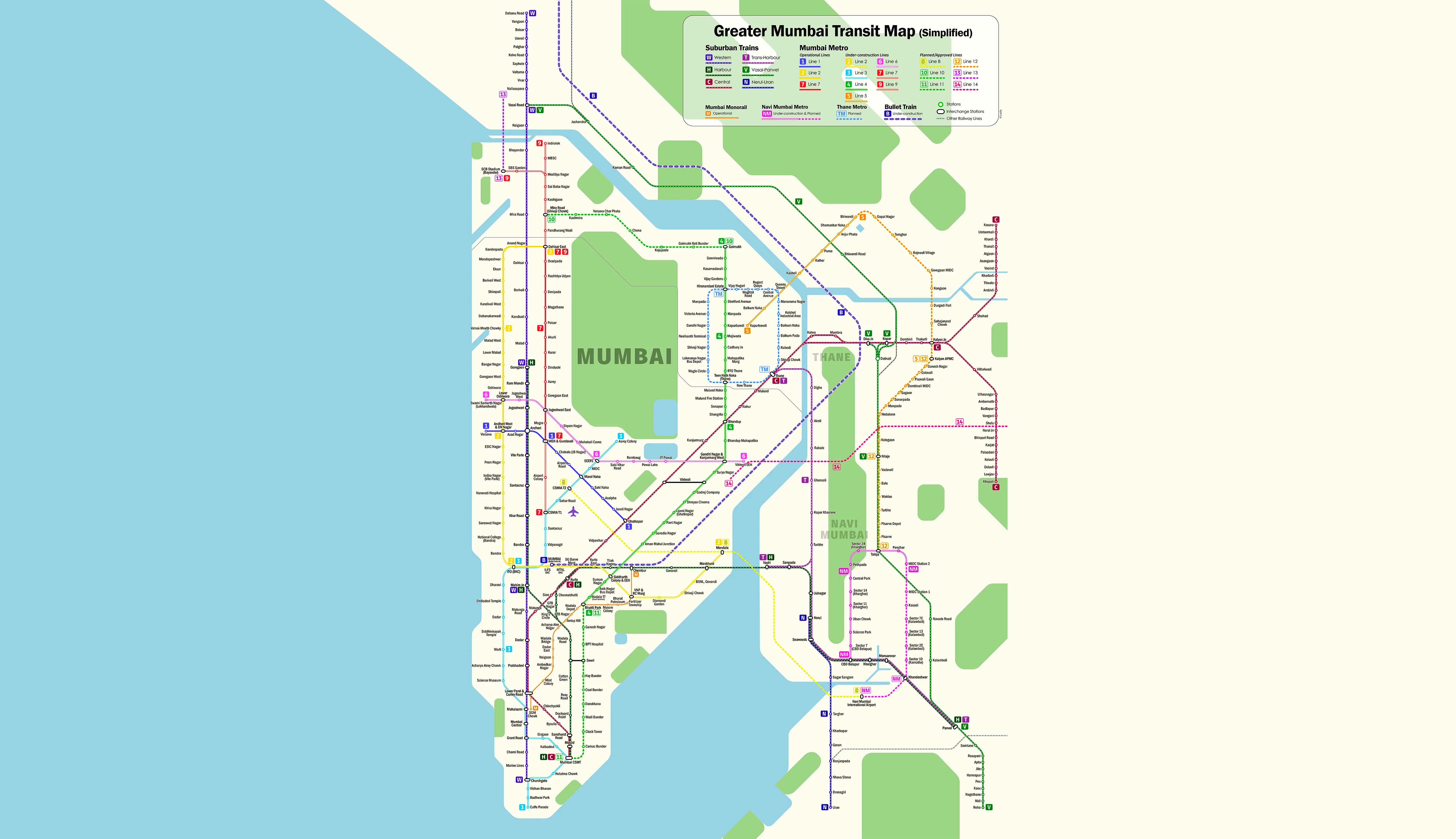
Tip: use browser zoom (Ctrl + scroll on desktop, pinch on mobile) for a closer look, or open the map full size in a new tab.
Map Legend
About the Mumbai Metro Map
The Mumbai Metro map above shows the entire network at a glance - operational lines, upcoming phases, and where each line meets the Mumbai suburban railway and monorail. Open it full size for a wider view, or download it for offline use.
Lines on the Mumbai Metro Route Map
The current Mumbai Metro network covers six operational lines: Blue Line (Versova to Ghatkopar), Yellow Line 2A (Dahisar East to Andheri West), Red Line 7 (Dahisar East to Gundavali), Aqua Line 3 (Aarey JVLR to Cuffe Parade), Purple Line 9 Phase 1 and Yellow Line 2B Phase 1. Green, Orange and Pink lines are under construction and appear on the map for reference.
Using the Mumbai Metro Map
Use browser zoom or open the map full size in a new tab if you need to trace a specific stretch. The Download button saves a high-resolution copy of the Mumbai Metro map to your device, handy if you want to check the route offline or share it with someone.
Plan Your Journey from the Map
Once you've picked your stations off the Mumbai Metro map, use the route planner to see distance, travel time and interchanges. Check fares and timetable before you leave, or find the nearest metro station to where you are right now.